3.1: African Continental Forecasting Process :
Step 1: Analysis of past weather :
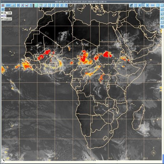
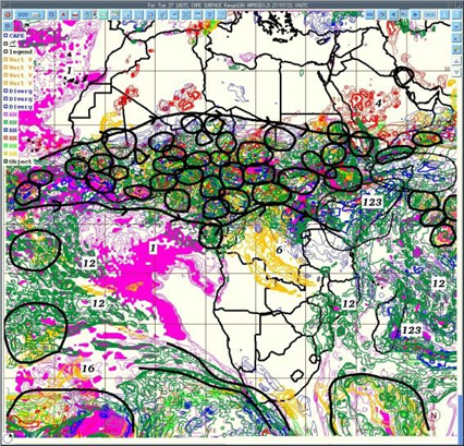
a) Analysis of Satellite images :
- The purpose is it review the forecasting accuracy by reviewing the last forecasted time lead(days) of satellite captured images from the sky. Review the weather system being prevailed those days and examine all parameters previous days and identify the point of forecasting gaps.
- Analysis of past convective system of decaying and increasing that need to consider for the next level of the forecast. Forecasters regularly use real-time nowcasting for this analysis.
- Analysis of forecast and statistical forecast data
PUMA nowcast
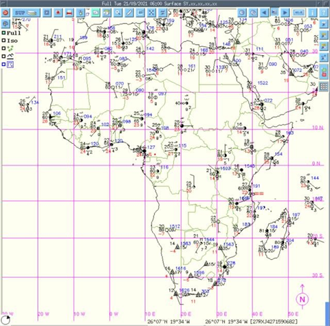
Analysis of the corresponding Synoptic chart: Rerecorded by the ground-based WMO-
designated synoptic ground observation weather stations across the continents ( around 1000 according to WMO).
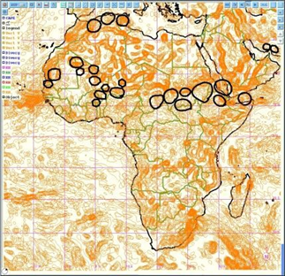
Step 2: Analysis of ITD (Inter-Tropical Discontinuity) :
Analysis of the limit between dry air ( harmattan[1] ) and moist air( monsoon), wind flow, deep convention, mean sea level pressure, etc. The diurnal cycle of ITD[2], i.e. the interface at the ground between moist monsoon air and dry Harmattan air, is an important factor in the West African monsoon system. During the whole of 2006, high-resolution groundbased remote-sensing measurements were performed in the area of Djougou, Benin, which made it possible to observe the ITD and the associated sharp gradient of temperature and humidity in detail.
[1] https://en.wikipedia.org/wiki/Harmattan
[2] Article in Quarterly Journal of the Royal Meteorological Society · January 2010 3 The unit for pressure is hectopascals (hPa)
Analysis of the movement of monsoon flux, the moist air coming from the south and dry air coming from the north. Deep convection occurs south of the ITD.
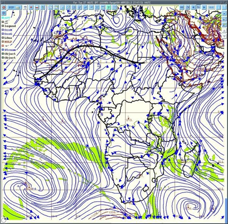
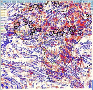
Step 3: Analysis of the synoptic drivers :
- Analysis of Winds ( at 925 hPa3 to analyze the monsoon flux ) velocity and direction
- Analysis of heat low ( area of low pressure which is the center of action of meteorology )
- Analyzing 850 hPa to observe wind vorticity
- 700 hPa to observe African easterly waves (AEWs) and wind direction
- Analyzing 600 hPa wind direction, AEWs, and African easterly jet (AEJ) which is very important for the convection
- Geopotential 500 hPa and temperature at 850 hPa
- Analysis 200 hPa to observe Tropical Easterly Jet (JET) and STJ ( Sub Tropical Jet)
Step 4: Analysis of deep convection parameters
winds Vertical velocity
Divergence and convergence of winds
Inter Tropical Convergence Zone (ITCZ) for deep convection areas
Analysis Relative Humidity at any levels
Analyzing the Wet bulb bulb potential temperature
Some other parameters and index
Vertical velocity of the wind
Areas of deep convection are those where all parameters are favorable
Step 5: Analysis of Deep Convection over Africa through areas common values of following;
a) Convergence (at low level) , Convergence( at medium level ) , Divergence( high level ) structures to updraft airmass
- Good value CAPE
- Very good value of Vertical velocity
- High values of relative humidity through the troposphere
- Taking in account synoptic drivers
Area with high vertical velocity
Low & mid-level convergence or divergence (airmass)
Convective Available Potential Energy (CAPE)[1] CAPE stands for convective available potential energy, and it is a useful tool for determining the severe weather potential at a given location at a given time. Using CAPE to Forecast Severe Weather.
[1] https://study.com/academy/lesson/convective–available–potential–energy–cape–definition–use–in–forecasting.html
Step 6: Prepare Forecast map and Bulletin :
• Determine areas where deep convection is supposed to occur with the type of rainfall and its intensity showing strong winds and giving warnings of weather based on heavy rain and strong winds. Forecasting of convection
Step 7: Forecast verification
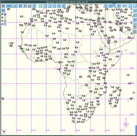
Satellite images indicate where deep convection occurs and synoptic data give an indication of registered rainfall at the synoptic (WMO) station across the African continent ( around 1000 stations).
…………………………………………………………………
For complete documents – Please email at : zmsajjad@gmail.com
The research is strictly copyrighting this researcher: Z M Sajjadul Islam, Multi-hazard early warning Expert
For Detailed knowledge, System design, ICT Technologies, Geospatial & IT Programmatic coding, and other issues related to Global Multi-hazard early warnings please email: zmsajjad@gmail.com
Call me at WhatsApp: +88 01711 979179, Skype: zmsajjad